Sunday, October 30, 2011

El Centro on The Balboa Park layout

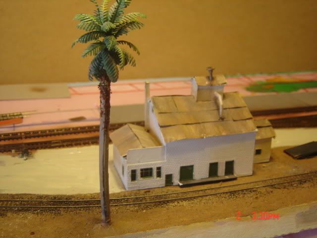
The Balboa Park San Diego and Arizona Eastern took some creative liberties with El Centro, as I remember it's a curved portion at the end of the layout with El Centro really well represented fantasy-wise. 


UP El Centro


Main and Commerce St in El Centro

Looking south from Main Street towards Calexico on mainline
Looking north at Main St crossing, former SD&AE depot and SP depot
El Centro engine service facility

Sunset over Campo from PSRM


1975 coming out of Mexico at San Ysidro


Cold Tecate anyone?

On the San Diego Model Railroad Club in Balboa Park

Wednesday, October 26, 2011

This is how the old SD&A got to Yuma

The Southern Pacific "Inter-Cal" line branched from the SP's Sunset Route at Niland, CA, ran southwards and entered Old Mexico at Calexico, CA/Mexicali, MX. It ran for some 50 miles east and re-entered the U.S./California at Algondones, MX, connecting with the SP Sunset Route at Araz Junction, about 5 miles west of Yuma, AZ. It was this railroad that the SP used to block the flood of water into the Imperial Valley that formed the Salton Sea (253' below sea level) in 1911.

A majority of the line was removed in the 1950s, especially south of the border in Mexico. The line from Niland to the border is still in use by Union Pacific.
It is said that train orders for the line were issued in both Spanish and English.

Thanks to Paul McGuffin for contributing information about this route.

ICC Abandonment Filings

SOUTHERN PACIFIC RAILROAD
Docket Number: 20408Date: 11/17/1958Section: 1(18)
App. for auth. to abandon its line between M. P. 760.693 at the Internat'l, Boundary Line between the Rep. of Mex. and the U.S.A., at or near Cantu, and M. P. 763.388 at or near Araz Junction, a distance of 2.695 mi., together with all sidings, spur tracks and appurtenances, located in Imperial County, Calif.
Length: 2.695 milesCitation: 307 ICC 805

Saturday, October 22, 2011

This is my version of Commerce Street near depot and Holtville Wye

El Centro, California -This is looking West from Commerce St. This is actually a two sided large loading dock and an empty packing facility. I will model the depots in the back and some of the structures with Highway 86 on the backdrop. 


Friday, October 21, 2011

First culprit is...

San Diego is our first victim to tackle on The SD&AE. A single track from the Santa Fe depot might be included to the yard at 12th street. Or we could begin with the terminus or the yard in San Diego and maybe a run around ahead of the yard. This line stopped and started here. It had it's AT&SF interchange at the North end of the yard near the underpass. The AT&SF yard was on the other side of Harbor Drive or the old 101 from the SD&AE.

There were several sidings (spurs) that crossed 101 to the peirs on the other side and The Westgate Tuna Company. Then on the right side or East side (looking North) was the lead to the El Cajon Branch, which ran down Imperial Ave. with trackwork in the street for a portion.

The tracks out of the yard pass large gas towers/tanks and tightly run on the East side of Highway 101 with a few industries from the yard to National City. The Santa Fe tracks were on the other side of 101 and served the other piers, ports and NASSCO: Shipbuilders. Using Google or Bing maps, you can get a better idea of the layout, even though the trolley and other incarnations of the SD&AE have replaced the lines, the layout hasn't changed.

Thursday, October 20, 2011

SD&AE Track Plans

I've been thinking if I won the lottery and could build this line, how would I do it? Or how would I build different versions of it from different plans. Before I get our friend David K. Smith busy on three versions on different points of the layout from Downtown San Diego to El Centro, what are the best choices to model.

San Diego Yard and Waterfront
Campo to Dos Cabezos with Goat Canyon
Plaster City to El Centro                      

I started thinking I could model on a hollow core door, El Centro to Plaster City and now I have switched to an A-B sided door. El Centro on one side and Dos Cabezos on the other. Maybe one idea is Plaster City to Dos Cabezos with great desert detail and rugged arid rock filled mountains.

The San Diego yard would be awesome from the yard to waterfront spurs and mainline to industries down Harbor Drive. We will be blogging about this over the next few weeks and hopefully get some input from our readers on their favorite parts of The Impossible Railroad.

Friday, October 7, 2011

Take a ride....

http://www.sdrm.org/gallery/sda/gorge/slideshow.html

Octotillo March 1980


Stored in Dos Cabeza


We get letters....


I recently discovered that my great grand-father was an employee of SD&A Railway. 

Could you recommend where I could find information on the earliest years of SD&A Railway?
His name was Erastus "Ras" Craig. He moved from Texas about 1895 to the Stockton, CA area. He is listed as a SD&A "road master" in the 1910 US Census. He died about 1918, perhaps on the job or a victim of the influenza epidemic. 

You have an interesting web site. I don't know anything about model systems but do like the history that you include. 

Thanks for any suggestions,

Rowland Craig
San Antonio, TX

Tuesday, October 4, 2011

Fictitious Imperial Valley Feed and Supply in El Centro


Lean, clean and mean


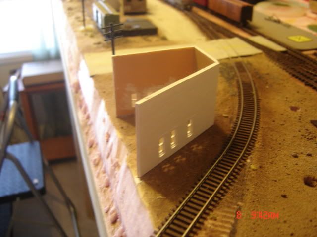
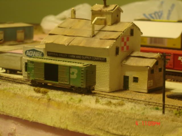
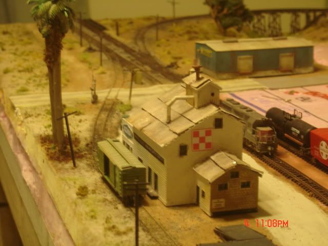
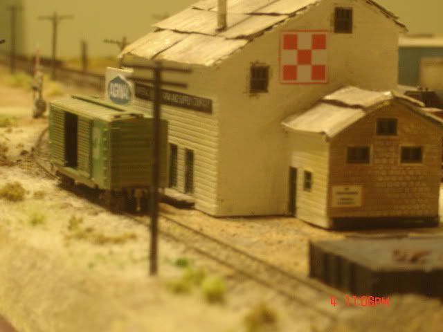
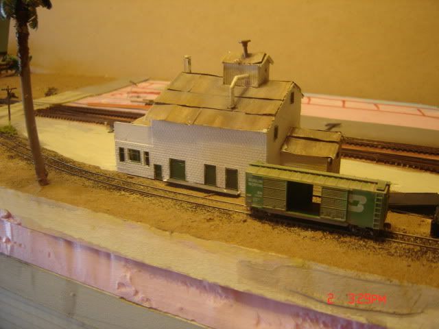
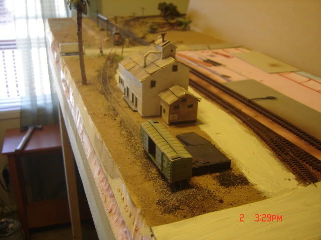
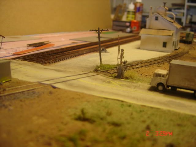
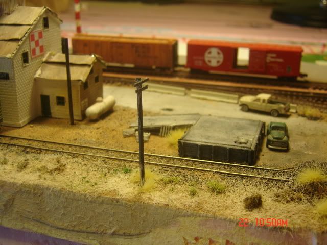
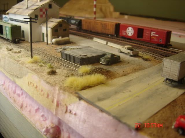
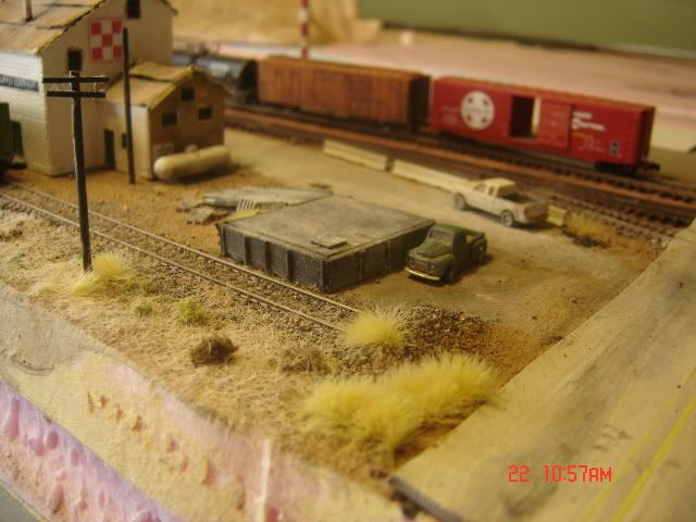
What I am trying to achieve in a multiple dimension, minimalist look to this hollow core door layout representing The San Diego and Arizona Eastern Railroad (Southern Pacific) From El Centro to Seeley (New River) and  onto Dos Cabezas. I have been inspired by the clean and aesthetically pure look of Mark Lestico's layout, John Leader's work and in HO Pele'
Soeberg. The end result is a deeper, detailed atmosphere, without clutter. Especially modeling desert scenes.


Across Carrizo Gorge

The Carizzo Gorge Railway (NOTE: Mission Impossible Theme for The Impossible Railroad)